The Roads That Time Forgot: America's State Highways Are Hiding a Version of the Country You've Never Seen
Every road trip algorithm wants to send you the same direction. Fastest route. Fewest turns. Merge onto I-whatever and stay there for the next four hours. It's efficient, reliable, and about as interesting as a loading screen.
But if you zoom out on almost any state map and look at the thin lines running parallel to the interstates — the two-digit and three-digit state routes that nobody seems to use anymore — you start to notice something strange. These roads still exist. They're still paved, still signed, still technically part of the American highway system. And in many cases, they look almost exactly the same as they did in 1962.
That's not an accident. It's the unexpected side effect of being forgotten.
How Interstates Accidentally Became a Preservation Machine
When the Interstate Highway System started reshaping American travel in the late 1950s and '60s, it didn't just build new roads. It effectively drained traffic from thousands of existing state routes almost overnight. Towns that had survived for decades on the flow of highway travelers suddenly found themselves sitting on roads that nobody was using anymore.
The businesses that couldn't adapt closed. The motels, the diners, the filling stations with the hand-painted signs — many of them locked their doors and just... stayed that way. And the roads themselves, without the pressure of heavy commercial traffic and constant expansion projects, stopped changing too.
What you're left with, decades later, is an accidental archive. Drive the right state route in rural Ohio, or the Texas Hill Country, or the back roads of Maine, and you'll pass through stretches of America that the interstate era essentially bypassed entirely. The architecture is original. The scale is human-sized. The pace is something you can't manufacture.
A Few Routes Worth Actually Seeking Out
State Route 1 in California gets all the attention, but it's hardly a secret anymore. The more interesting finds tend to be humbler.
US-50 through Nevada is sometimes called the Loneliest Road in America — a designation that was originally meant as an insult, printed in a 1986 Life magazine article warning travelers away. Instead, it became an accidental badge of honor. The route passes through tiny towns like Eureka and Ely, where the storefronts and signage feel genuinely mid-century, not because anyone curated them that way, but because nobody got around to replacing them.
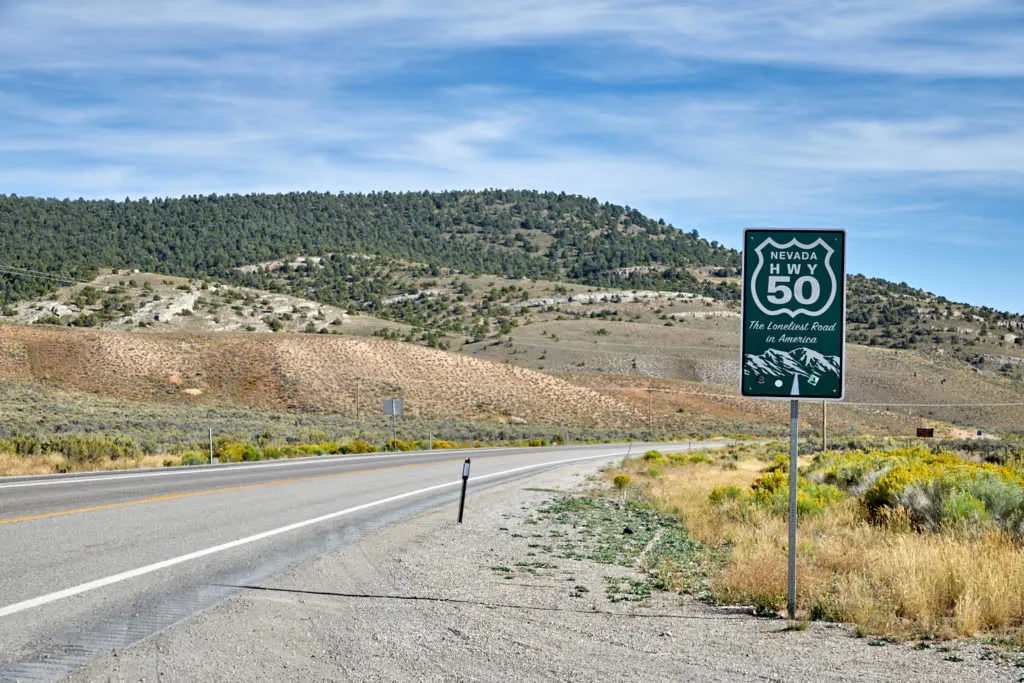 Photo: US-50 through Nevada, via www.sussner.net
Tennessee State Route 30 through the Cumberland Plateau winds through small communities that sit almost completely outside the modern tourist economy. You'll find gas stations that sell homemade preserves next to the motor oil, and stretches of road where the tree canopy closes overhead like a tunnel.
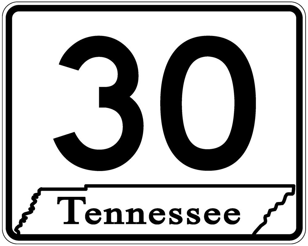 Photo: Tennessee State Route 30, via www.100yearsofroadfunding.com
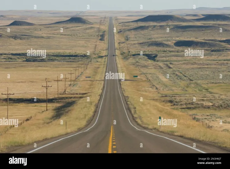
US-83 through the Great Plains — running from the Canadian border all the way to the Texas coast — cuts through a version of rural America that most coastal residents have never encountered. The towns are small, the distances between them are real, and the landscape has a scale that makes the interstate feel like a toy.
None of these routes will show up in a travel magazine's "Best Road Trips" list. That's exactly the point.
The Algorithm Problem
Here's something worth thinking about: modern navigation doesn't just find the fastest route. It shapes what we think of as the route. When every driver in a region follows the same GPS recommendation, the roads those algorithms ignore don't just get less traffic — they get less awareness. They become invisible.
For the people who live on those roads, that invisibility is often a frustration. For the curious traveler, it's an invitation.
The travel writer William Least Heat-Moon spent a year in the late 1970s driving what he called "blue highways" — the thin, secondary roads on old paper maps that were printed in blue. His book about that journey became a quiet classic precisely because he was documenting something most Americans had already decided wasn't worth their time. Forty-plus years later, the blue highways are still there. They're just harder to find when your map is an app.
 Photo: William Least Heat-Moon, via threeroomspress.com
How to Actually Find These Routes
The simplest method is the oldest one: buy a paper state road atlas. The DeLorme Atlas & Gazetteer series covers individual states in remarkable detail, including roads that mapping apps either don't show or actively route you around.
Look for routes with three-digit numbers — they're almost always secondary, quieter, and more likely to pass through small towns rather than bypassing them. Look for roads that run roughly parallel to a nearby interstate. Those are the routes that existed before the freeway, that once carried all the traffic, and that have been sitting in relative quiet ever since.
Give yourself time you don't need to spend. That's the other essential ingredient. The whole point of a road that time forgot is that it doesn't reward hurrying.
The Best Version of the Country Is Off the Algorithm
There's a version of America that the travel industry doesn't know how to sell because it isn't a destination — it's a texture. It's the quality of light through a windshield on a two-lane road in September. It's a diner where the pie is actually homemade and the coffee comes in a ceramic mug. It's the particular silence of a small town on a Tuesday afternoon.
You won't find it on I-70. But it's still out there, waiting on roads that most people stopped driving decades ago — which means they're all yours.