When America's Roads Were Painted by Hand — The Trail Blazers Who Made Cross-Country Travel Possible
Picture this: It's 1916, and you want to drive from New York to San Francisco. There are no interstate highways, no standardized road signs, and definitely no GPS. How do you even know which dirt road to take?
The answer lies in one of America's most overlooked chapters of ingenuity — the volunteer trail blazers who literally painted their way across the continent.
The Great American Road Marking Project
In the 1910s and 1920s, as automobiles became more affordable, Americans faced a peculiar problem: the roads existed, but nobody knew where they went. The federal highway system was still decades away, and local roads were a chaotic maze of unmarked paths, farm tracks, and former wagon routes.
Enter the trail blazers — volunteers from local auto clubs, booster organizations, and civic groups who took it upon themselves to create America's first navigation system. Armed with buckets of paint, brushes, and an almost missionary zeal, these ordinary citizens set out to mark every major route across the country.
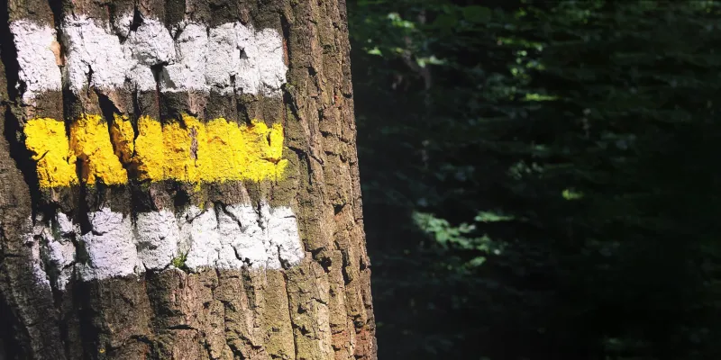
Their method was beautifully simple: paint distinctive symbols and colors on whatever was available. Trees got white blazes with colored stripes. Telephone poles received bands of paint in specific patterns. Stone cairns appeared at crucial intersections. Each route had its own color code and symbol system, created and maintained entirely by volunteers.
The Lincoln Highway's Red, White, and Blue Revolution
The most famous of these early marked routes was the Lincoln Highway, America's first transcontinental road stretching from Times Square to San Francisco. The Lincoln Highway Association, formed in 1913, developed an elaborate marking system that became the template for others.
Their markers were works of folk art: concrete posts topped with bronze medallions, painted telephone poles with red, white, and blue stripes, and even painted rocks at key decision points. Volunteers would spend entire weekends walking or driving sections of the route, touching up faded paint and replacing damaged markers.
The dedication was remarkable. Local chapters adopted specific mileage segments, treating them like community gardens. Farmers would report damaged markers to the nearest auto club. Small-town merchants sponsored marker maintenance as a form of civic pride.
A Patchwork of Competing Systems
What made this era fascinating was its beautiful chaos. Different trail associations developed their own marking systems, sometimes overlapping on the same roads. The Dixie Highway used yellow and black markers. The National Old Trails Road preferred red and white. The Yellowstone Trail — which connected the upper Midwest to Yellowstone National Park — used distinctive yellow blazes.
Drivers needed guidebooks to decode the symbols, creating a cottage industry of trail guides and route maps. These publications read like treasure maps, with instructions like "Follow the blue diamonds until you see the red and white striped pole, then turn left at the painted boulder."
The Science Behind the Paint
These amateur cartographers were surprisingly sophisticated. They understood visibility principles that modern traffic engineers still use today. Markers were placed at eye level for seated drivers. Colors were chosen for maximum contrast against natural backgrounds. Symbols were kept simple enough to recognize at early automobile speeds — which rarely exceeded 25 mph on these rough roads.
The volunteers also developed maintenance schedules that accounted for weather patterns. They knew that south-facing markers faded faster and that certain paint formulations lasted longer on different surfaces. This was practical chemistry learned through trial and error, passed down through local auto club newsletters.
Hidden in Plain Sight
Here's the remarkable part: some of these hand-painted markers are still out there.
In rural areas where old roads haven't been completely rebuilt, you can occasionally spot the ghosts of trail blazing. Faded paint on ancient telephone poles. Stone cairns that seem oddly deliberate. Trees with suspicious scars where metal markers once hung.
The Lincoln Highway Association has documented hundreds of surviving original markers, many hiding in small towns that were bypassed when the interstate system arrived. These artifacts represent something profound: the moment when ordinary Americans decided to solve a national problem with nothing but volunteer labor and buckets of paint.
Why This Matters Today
The trail blazing movement reveals something essential about American problem-solving culture. Faced with the challenge of unmarked roads, communities didn't wait for government solutions — they grabbed paintbrushes and got to work.
This volunteer spirit created the foundation for everything that followed. The federal highway system, standardized road signs, and even modern GPS navigation all built upon the routes and principles established by these amateur trail blazers.
Next time you're following GPS directions on a perfectly marked interstate, remember the volunteers who walked those same paths a century ago, painting the way forward one tree at a time. They turned America's roads from an unmarked wilderness into a navigable network, using nothing more than community spirit and a lot of paint.
Their legacy isn't just in the faded markers still hiding along forgotten stretches of highway — it's in the very idea that getting somewhere should be possible for everyone, even if you have to paint the path yourself.