The Road You Think You Know
Every morning, millions of Americans drive routes they assume were designed by 20th-century engineers armed with surveys and blueprints. But scratch beneath the asphalt of many major highways, and you'll find something far older: paths worn smooth by countless feet over thousands of years, trade routes that connected distant tribes, and travel corridors that Indigenous peoples perfected long before anyone dreamed of automobiles.
The story of how ancient footpaths became modern interstates is one of America's most overlooked chapters — a tale of borrowed wisdom that highway departments rarely advertise and most drivers never suspect.
Following the Footsteps
The evidence is hiding in plain sight once you know where to look. Interstate 75, which runs from Michigan to Florida, follows portions of what archaeologists call the "Great Indian Warpath" — a network of trails that connected Cherokee territories in the Southeast with Iroquois lands in the Northeast. U.S. Route 1, hugging the Eastern seaboard, traces ancient coastal trading routes used by dozens of tribal nations.
Out west, the pattern repeats with stunning consistency. California's Highway 101 follows Native American pathways that connected coastal villages for millennia. Parts of Interstate 40 mirror the route of the Old Spanish Trail, which itself borrowed from even older Indigenous routes across the Southwest.
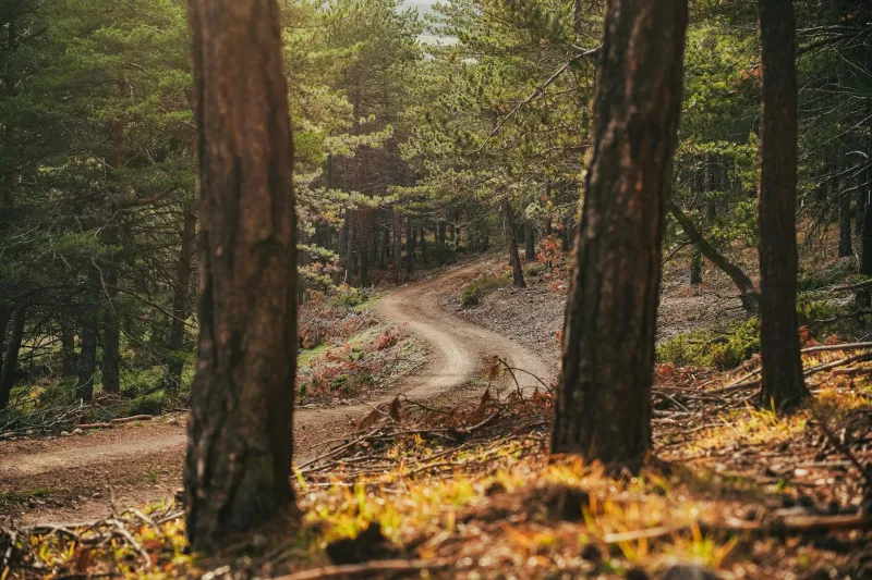
 Photo: California's Highway 101, via s.hdnux.com
"When you're moving people and goods across a landscape, there are optimal paths," explains Dr. Sarah Winnemucca, an archaeologist specializing in pre-Columbian transportation networks. "Native peoples had thousands of years to figure out the best routes. Early European settlers, and later highway engineers, were smart enough to follow their lead."
The Science of Ancient Route-Finding
Indigenous trail-builders weren't just wandering randomly across the continent. They were sophisticated engineers who understood principles that modern highway designers still use today: gradual grades instead of steep climbs, routes that avoided flood zones, paths that provided access to water and shelter.
Archaeological surveys reveal the careful thought that went into these networks. Trails typically followed ridge lines to avoid marshy valleys. They curved around hills rather than going straight over them. They connected reliable water sources and avoided areas prone to seasonal flooding.
These weren't accident-prone footpaths — they were carefully engineered transportation corridors designed for efficiency and safety. When 20th-century highway planners surveyed the same terrain with modern equipment, they often reached identical conclusions about optimal routing.
The Buffalo Commons Connection
Some of America's most famous roads began not as human trails, but as animal highways. The Great Buffalo Trail, which stretched from the Great Lakes to the Gulf of Mexico, became the foundation for numerous modern routes. Buffalo, it turns out, were excellent civil engineers — they instinctively chose paths with gentle grades and reliable water access.
Native American hunters and traders adopted these buffalo highways, improving them with bridges, markers, and shelter stations. European settlers later followed the same routes, and eventually highway engineers paved right over them.
Interstate 35, running from Minnesota to Texas, follows portions of this ancient buffalo-to-human-to-automobile progression. The route that once carried massive herds across the Great Plains now carries millions of vehicles along remarkably similar paths.
Hidden Evidence in Modern Maps
The connection between ancient trails and modern roads becomes obvious once you start looking for it. County roads that make seemingly inexplicable curves through flat farmland are often following the contours of old Native American paths. State highways that take puzzling detours around empty fields may be avoiding areas that Indigenous peoples knew were prone to flooding or difficult terrain.
Even city streets carry these echoes. Boston's famously chaotic road network largely follows pre-colonial pathways used by local tribes. Broadway in Manhattan traces an ancient route that connected Native American settlements along the Hudson River.
"The landscape remembers," notes transportation historian Dr. Michael Standing Bear. "You can erase the people and pave over the trails, but the logic of the terrain remains the same."
The Forgotten Expertise
What's remarkable isn't just that modern highways follow ancient routes — it's how completely we've forgotten the expertise that created those routes in the first place. Indigenous peoples developed sophisticated systems for marking trails, maintaining them across seasons, and adapting them to changing conditions.
They created what amounted to continental GPS systems using natural landmarks, astronomical observations, and detailed oral maps passed down through generations. They established rest stops, supply caches, and emergency shelters along major routes. They even developed early forms of traffic management, designating certain paths for specific purposes and seasons.
Modern highway engineers had to reinvent many of these concepts, often without realizing they were rediscovering ancient solutions.
The Debt We Don't Acknowledge
Today's interstate system is often celebrated as a triumph of American engineering and vision. And it is — but it's also the latest chapter in a much longer story of transportation innovation that began thousands of years before the first European set foot on the continent.
The irony is profound: a nation built on the displacement of Indigenous peoples continues to rely daily on their transportation expertise. Every commute to work, every road trip vacation, every commercial delivery follows routes that were first optimized by the very cultures that American expansion sought to erase.
Reading the Landscape
Once you understand this hidden history, every drive becomes an archaeological expedition. That seemingly random curve in the highway might be following a thousand-year-old path around a seasonal marsh. That rest stop positioned at just the right spot might sit on an ancient campsite chosen for the same reasons — water access, protection from weather, and strategic positioning along the route.
The next time you're driving a familiar route, consider that you might be following footsteps that are older than recorded history. Your morning commute could be tracing a path worn smooth by countless generations of travelers who faced the same basic challenge you do: getting from here to there as efficiently and safely as possible.
They solved that problem remarkably well. We're still following their lead.